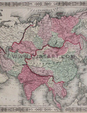
Year: 1863
Cartographer: Alvin Jewett Johnson
Publisher: Johnson and ward, Johnson's new illustrated (steel plate) family atlas, 1863 edition
Print Size: 35.5 x 28 cm / 14 x 11.2 Inch
Sheet Size: 40 x 33 cm / 16 x 13 Inch
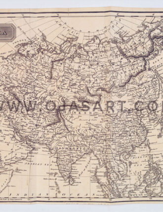
Year: London, ca. 1814
Cartographer: Alexander Findlay
Engraver/Printer: Alexander Findlay
Publisher: Kelly, Thomas
Print Size: 30 x 22 cm / 12.2 x 9 Inch
Sheet Size: 32 x 24 cm / 12.6 x 9.7 Inch
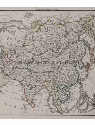
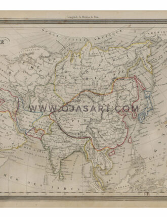
An antique map of Asia engraved with bordering. The map shows Empire Russe, Empire Chinois, Hindoustan, Arabia, Kaboul and more.
Print Size: 44 x 30 cm / 17.5 x 12 Inch Sheet Size: 47 x 33 cm / 18.8 x 13.3 Inch
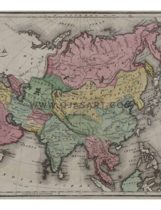
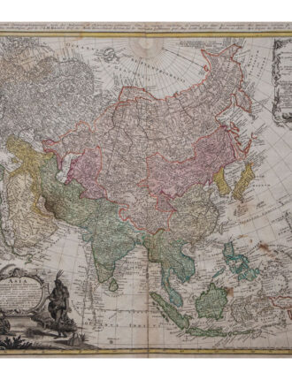
“Asia Secundum Legitimas Projectionis Stereographicae Regulas et Juxta Recentissimas Observationes… / Carte de l’Asie Projettee Stereographiquement Tiree des Relations et Observations…”
Year:1744
Engraver: J.M.Haas & Gottlieb Boehm
Map Size: 21.8 x 19.5 Inch | 55 x 49 cm
Year: Late 19th Century
Cartographer: A. Bixet
Engraver/Printer: L.Smith
Publisher: J. Migeon, Paris, France
Print Size: 46 x 36 cm / 18.2 x 14.3 Inch
Sheet Size: 49 x 38 cm / 19.5 x 15.2 Inch
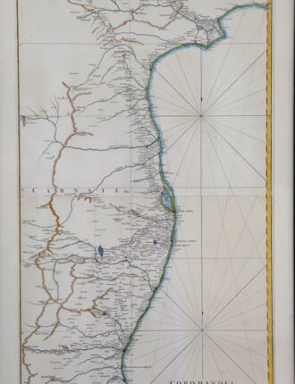
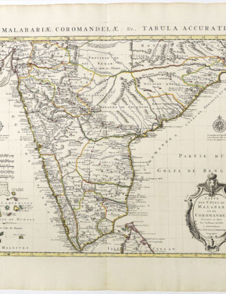
Coromandel Par le Sr. d'Anville, Secretaire de S.A.S.Mgr. le Duc d'Orleans. (Grave par) Guill? De-la-Haye. (Paris), Janvier, 1753.
Year: 1753
Engraver|Printer: Guillaume de la Haye
Size: 19.8 x 38.3 Inch | 50 x 97 cm
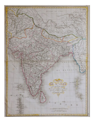
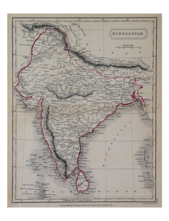
Hindoostan Year: 1829
Cartographer: An Atlas of Modern Geography by Samuel Butler, D.D.
Engraver|Printer: Sidney Hall & Selina Price Hall
Publisher: Longman, Rees, Orme, Brown & Green, London, 1829
Map Size: 7.5 x 9.5 Inch | 19 x 24 cm
Paper Size: 8 x 10.2 Inch | 20 x 26 cm
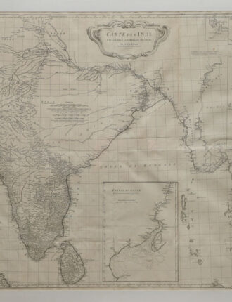
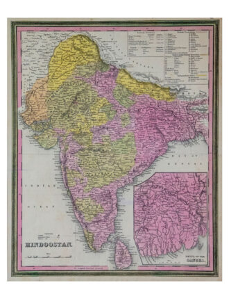
Hindoostan Year: Philadelphia, 1846
Cartographer: Samuel Augustus Mitchell
Engraver|Printer: Samuel Augustus Mitchell
Publisher: Samuel Augustus Mitchell
Map Size: 12 x 15 Inch | 30 x 38 cm
Sheet Size: 12.5 x 15.5 Inch | 31 x 39 cm