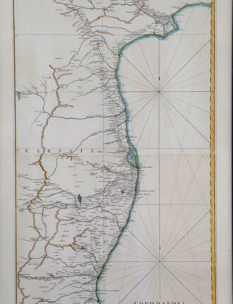
A large map of 18th century India, published by D’Anville in 1752. It reflects the state of knowledge of this area mid-century. The map shows excellent detail of Southern India and coastlines. The two inserts are the environs of Goa, and the entrance to the Hugli River. It features a decorative title cartouche. Jean-Baptiste Bourguignon d’Anville (1697-1782) was one of the foremost French geographers of the eighteenth century. He performed serious research to create his maps, which greatly developed the technical proficiency of mapmaking during his lifetime. His style was simpler and less ornate than that of most of his predecessors. It was widely adopted by his contemporaries and successors.