Cart (0)
Close
-
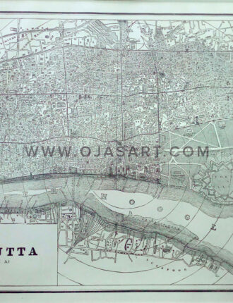
1893 Map of The City of Calcutta India
₹21,000.00Year: 1893 Published by Pierce Brothers Source: Atlas Colombian Worlds Fair Print Size: 31 x 27 cm / 12.5 x 11 Inch Sheet Size: 34 x 22 cm / 13.5 x 9 Inch -
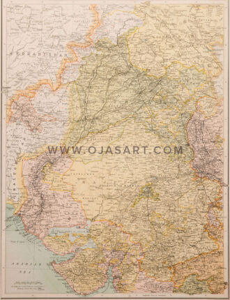
1898 -Northern India & Rajpotana
₹39,000.00Year: 1898 Cartographer: George Philip & Son – London&Liverpool Print Size: 49 x 59 cm / 19.5 x 23.5 Inch Sheet Size: 52 x 63 cm / 20.6 x 24.8 Inch -
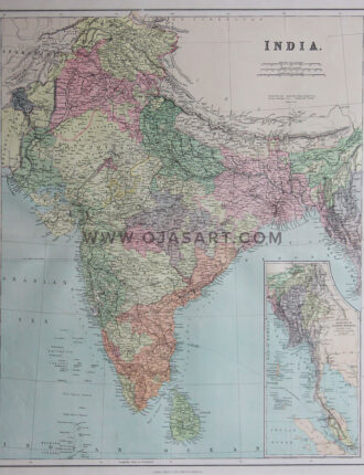
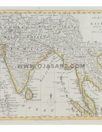
A Detailed 18th Century Map of India Frontier
₹10,000.00Year: 18th Century Publisher: John Barthalomew Print Size: 30 x 40 cm / 12 x 16 Inch Sheet Size: 30 x 40 cm / 12 x 16 Inch -
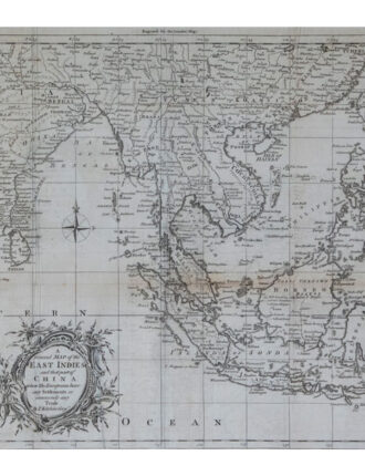
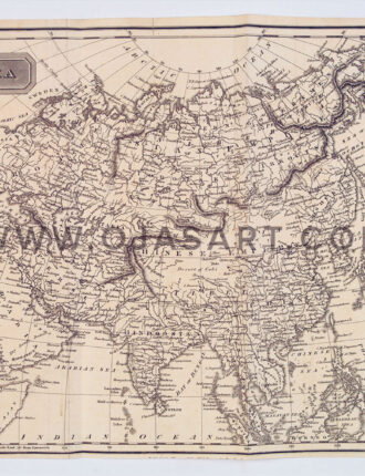
A General Map of the East Indies
₹51,000.00A General Map of the East Indies and that part of China where the Europeans have any Settlements or commonly any Trade Cartographer: Kitchin, Thomas Publisher : T. Kitchin, Geogr. Map Size: 16.5 x 12 Inch | 42 x 30 cm -
An Accurate Map of The East Indies
₹24,000.00Year: Year: 1788 Cartographer: BOWEN Print Size: 29 x 19 cm / 11.5 x 7.7 Inch Sheet Size: 31 x 21 cm / 12.5 x 8.5 InchCartographer: BOWEN Print Size: 29 x 19 cm / 11.5 x 7.7 Inch Sheet Size: 31 x 21 cm / 12.5 x 8.5 Inch -
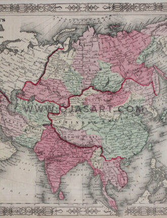
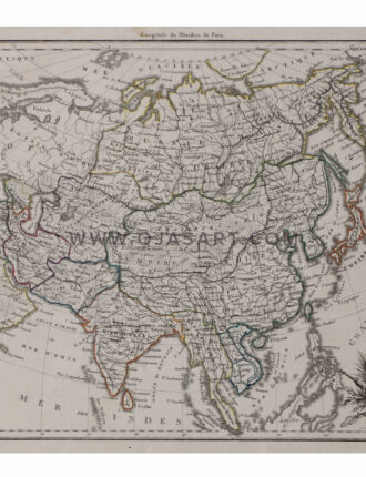
Asia Asia General
₹12,000.00. Print Size: 29 x 21 cm / 11.5 x 8.5 Inch Sheet Size: 31 x 23 cm / 12.5 x 9.2 inch -
Asie Ancienne
₹21,000.00Year: Paris, 1812 Publisher: Malte-Brun, Conrad Print Size: 29 x 21 cm / 11.6 x 8.5 Inch Sheet Size: 33 x 22 cm / 13 x 9 Inch -
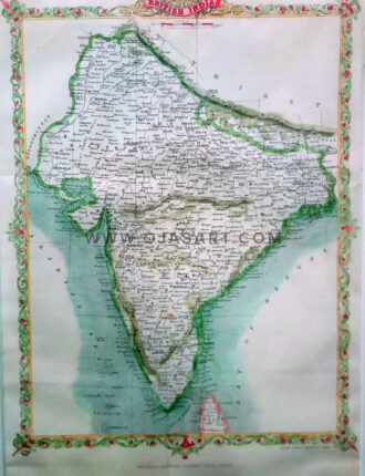
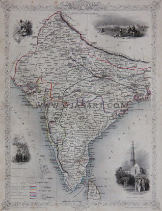
British India
₹21,000.00Engraver/ Printer: J Rapkin Print Size: 22 x 30 cm / 9 x 12 Inch Sheet Size: 25 x 36 cm / 10.2 x 14.5 Inch -
British India
₹30,000.00Year: 19th Century Cartographer: John Tallis Engraver/Printer: John Rapkin Publisher: John Tallis Print Size: 21 x 29 cm / 8.5 x 11.5 Inch Sheet Size: 27 x 35 cm / 10.7 x 14 Inch -
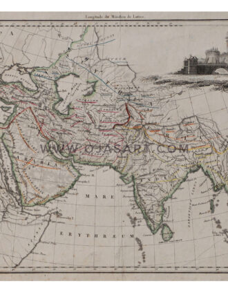
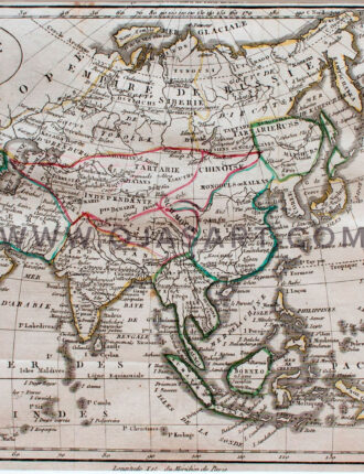
Carte d’ Asie
₹19,000.00Year: 1805 Publisher: Guthrie Print Size: 22 x 19 cm / 9 x 7.5 Inch Sheet Size: 22 x 19 cm / 9 x 7.5 Inch -
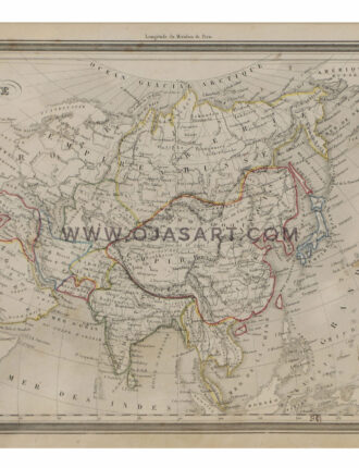
Carte d’ Asie
₹24,000.00Year: 1805 Publisher: Guthrie. Print Size: 25 x 19 cm / 10 x 7.5 Inch Sheet Size: 27 x 20 cm / 11 x 8.2 Inch -
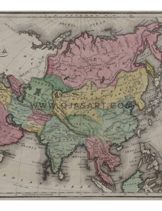
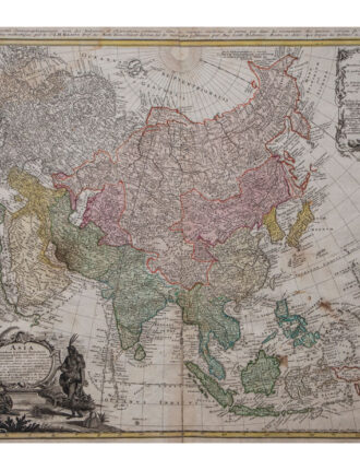
Carte De Asie
₹150,000.00“Asia Secundum Legitimas Projectionis Stereographicae Regulas et Juxta Recentissimas Observationes… / Carte de l’Asie Projettee Stereographiquement Tiree des Relations et Observations…” Year:1744 Engraver: J.M.Haas & Gottlieb Boehm Map Size: 21.8 x 19.5 Inch | 55 x 49 cm